Whereas the idea of sending humans to Mars was once relegated to science fiction, NASA hopes it will become a reality by the late 2000s.
But one of the main questions we need to solve before blasting off to the Red Planet, is where to land.
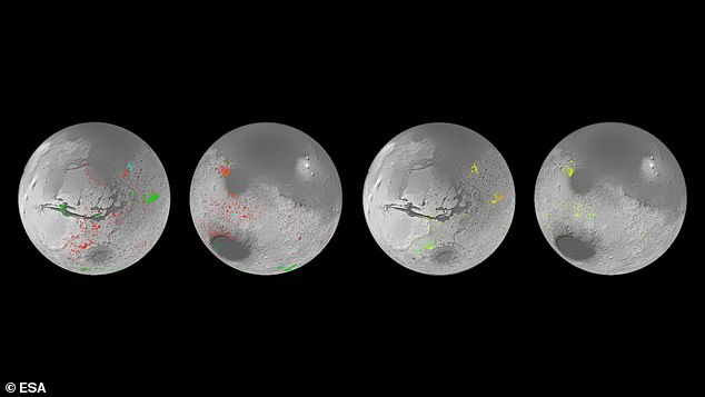
Now, scientists from the European Space Agency (ESA) have created the first water map of Mars, based on data from NASA’s Mars Express and Mars Reconnaissance Orbiter.
The team hopes the map will change the way we think about Mars’ watery past and help determine where to land on the Red Planet in the future.
Scientists from the European Space Agency (ESA) have created the first water map of Mars, based on data from NASA’s Mars Express and Mars Reconnaissance Orbiter.
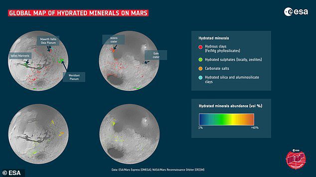
The map shows the locations and abundance of hydrated minerals on Mars.
These minerals are from rocks that have been chemically altered by water in the past and are usually converted into clays and salts.
While you might think these water minerals would be few and far between, the biggest surprise is their prevalence on Mars, where the map revealed hundreds of thousands of these areas.
“This work has now demonstrated that when you study ancient topography in detail, not seeing these minerals is actually quite odd,” said Dr. John Carter of the Astrophysical Institute Spatial.
The big question now is whether this water is continuous, or confined to shorter, more intense bouts.
The European Space Agency hopes that the map will serve as a better tool to answer this question.
“I think we’ve collectively simplified Mars,” said Dr. Carter.
Scientists were previously inclined to believe that only a few types of clay minerals were formed on Mars during the Martian wet period.
Then, as the water gradually dried up, salts were produced across the planet.
However, the new map shows that the process was likely much more complicated than that.
While many of the salts may have formed later than the clays, the map shows that there are exceptions.

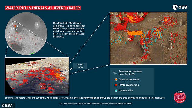
Data from NASA’s Mars Reconnaissance Imaging Spectrometer (CRISM) showed that Jezero crater displays a rich variety of hydrated minerals.

The European Space Agency’s Mars Express Observatoire pour la Mineralogie, l’Eau, les Glaces et l’Activité (OMEGA) instrument is more suitable for mapping with higher spectral resolution and provides global coverage of Mars
“The evolution from lots of water to no water isn’t as straightforward as we thought, the water didn’t stop overnight,” Dr. Carter explained.
We see so much diversity in geological contexts that no simple process or timeline can explain the development of mineralogy on Mars.
This is the first result of our study. The second is that if you exclude the processes of life on Earth, Mars exhibits a variety of minerals in geological environments just as Earth does.
To create the map, the European Space Agency used data from various tools.
For example, data from NASA’s Mars Reconnaissance Imaging Spectrometer (CRISM) has shown that Jezero crater displays a rich variety of hydrated minerals.
Meanwhile, the European Space Agency’s Mars Express Observatoire pour la Mineralogie, l’Eau, les Glaces et l’Activité (OMEGA) instrument is more suitable for mapping with higher spectral resolution and provides global coverage of Mars.
The researchers hope the map will be useful to NASA as it chooses where to land on Mars in the future.
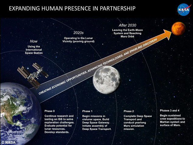
This news comes ahead of NASA’s Artemis I mission, which is scheduled to launch on August 29, paving the way for future missions to the Moon and Mars.
“Artemis I will be an unmanned flight test that provides a foundation for human exploration of deep space, and demonstrates our commitment and ability to extend human presence to the Moon and beyond,” NASA explained.
If the Artemis missions are successful, NASA aims to launch astronauts to Mars by the late 1930s or early 1940s.


More Stories
Boeing May Not Be Able to Operate Starliner Before Space Station Is Destroyed
Prehistoric sea cow eaten by crocodile and shark, fossils say
UNC student to become youngest woman to cross space on Blue Origin