Published on August 13, 2024 at 8:46 pm
This phenomenon is slow to catch on and it can have consequences. forecast.
La Niña is taking its time
Last spring, NOAA experts predicted a gradual return of the La Niña phenomenon during the summer. After a months-long El Niño episode, there are signs to expect a cooling of the surface waters of the equatorial Pacific. Depending on the models, the transition to the neutral state may take some time. In fact, the probabilities increase significantly during the September-October-November quarter.
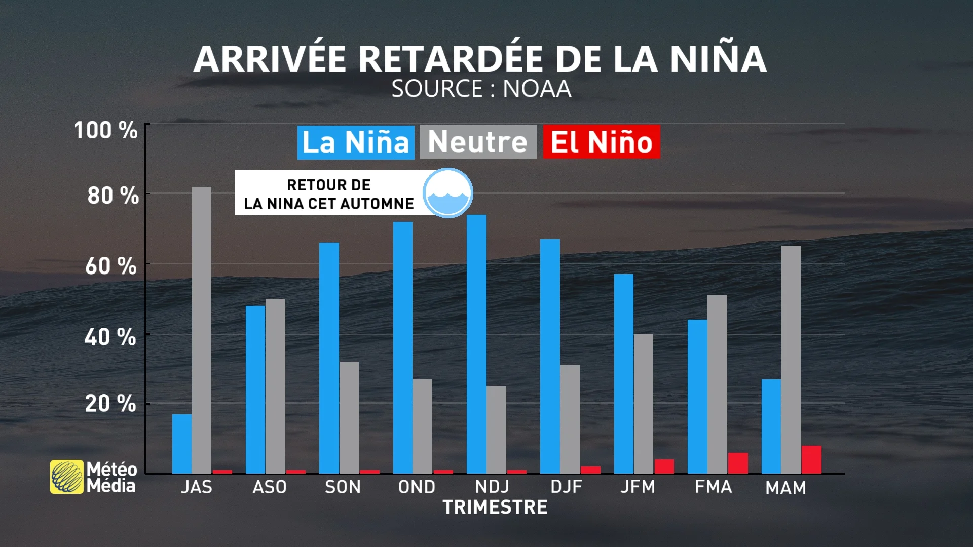
Strong signals
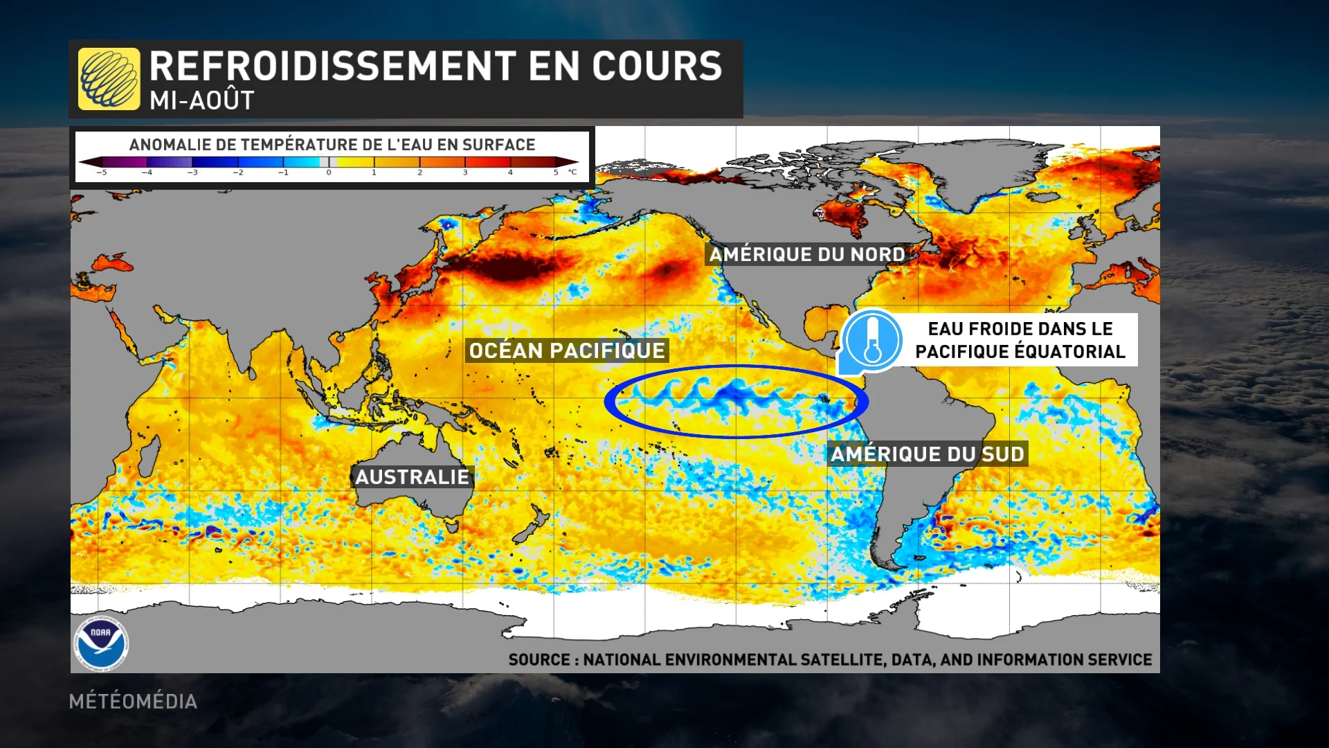
Even if the return of La Niña is delayed, cooling of the surface waters of the equatorial Pacific is already underway. For the event to be triggered, the anomaly must exceed a threshold of 0.5°C in a specific area. If the water temperature is unusually cold, La Niña forms. Instead, it’s El Nino. Currently, the area in this basin is in a neutral state.
Significant impacts
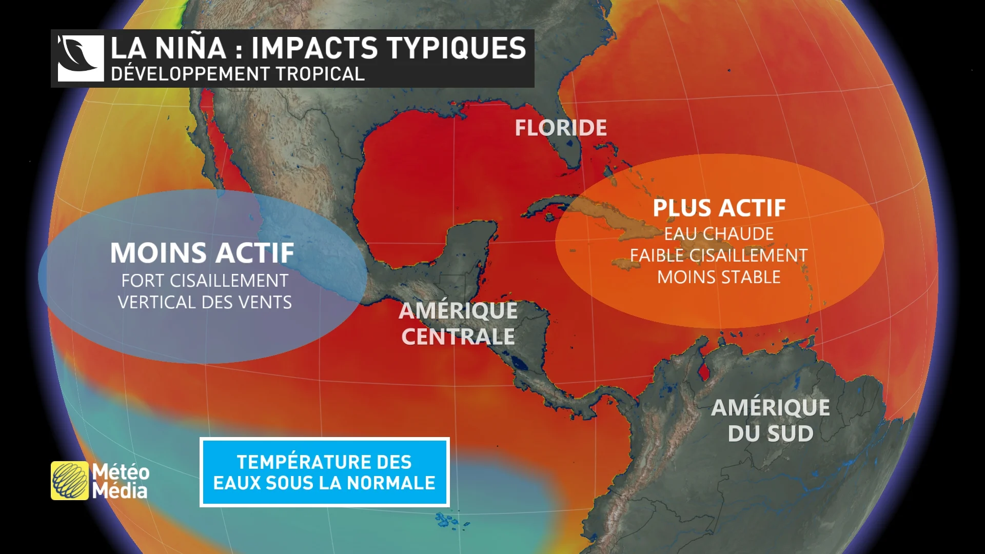
A delay in the arrival of La Niña could have several consequences in North America. When the waters in the equatorial Pacific become unusually cold, conditions become favorable for the formation of tropical storms in the Atlantic. In fact, materials coalesce when water is warm and there is little wind shear (change in direction and speed). Note that although La Niña has yet to begin, remnants of tropical storms have made landfall in Quebec more than once this season. However, if the circumstances were favorable, the situation could have been worse.
Carol-Ann Veilleux, meteorologist in collaboration.


More Stories
Exaggerations and Hoaxes: 10 False Statements at the Democratic Convention
Sicily shipwreck: Body of last missing person found, daughter of Mike Lynch
53 migrants dead in Texas: Man awaiting deportation to US arrested in Guatemala